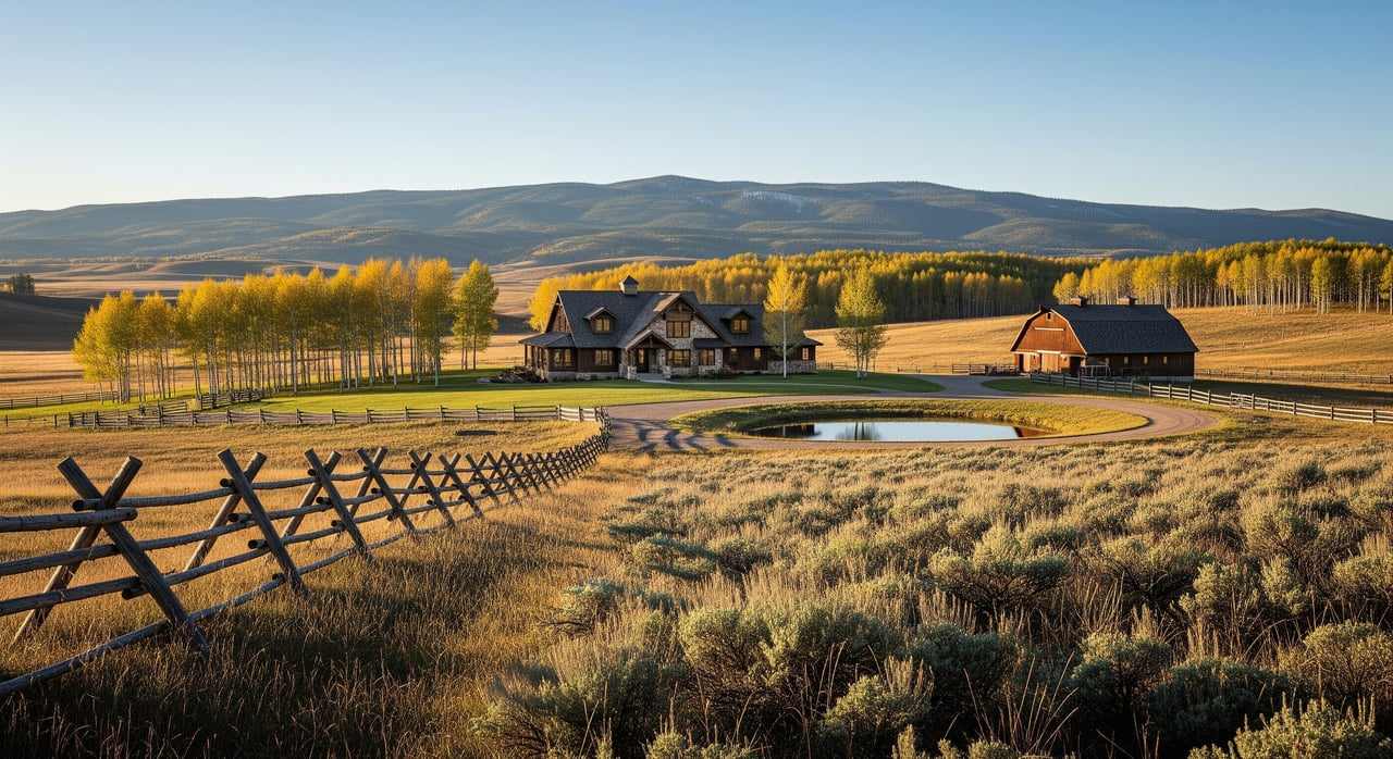
Thinking about buying ranch land in Star Valley Ranch but not sure where to start? The right parcel can support your lifestyle and long-term plans, yet mountain-valley properties come with unique legal and physical details. One overlooked easement, water right, or access issue can change what you can build, graze, or enjoy. This guide walks you through a practical, step-by-step due diligence checklist tailored to Star Valley Ranch and Lincoln County so you can move forward with confidence. Let’s dive in.
Your due diligence checklist
1) Gather core documents
Start by assembling a clean file. Request seller disclosures, the preliminary title report, the recorded plat and legal description, and any covenants or CC&Rs. If the land is within Star Valley Ranch, ask for Property Owners Association (POA) documents, meeting minutes, architectural standards, and fee schedules.
Ask the seller or listing agent for any recorded easements, road maintenance agreements, and the history of water use. Note any wells, ditches, ponds, springs, or stockwater improvements. A complete file saves time later.
2) Review title and mineral estate
Order a title commitment and read every exception. Look for easements, rights-of-way, covenants, and any conservation easements that could limit subdivision, commercial activity, or new structures. Confirm whether mineral rights are included or were severed in a prior deed.
If minerals are severed, check for active or recent energy leases or permits in the area. Consult a local title company or a Wyoming real estate attorney for questions about surface use, mineral reservations, or curable title exceptions.
3) Confirm access and easements
Legal access is essential for year-round use and financing. Verify whether the parcel fronts a public road, uses a recorded private easement, or depends on prescriptive access. Map where gates are located, which roads are platted, and whether neighbors share access rights.
Clarify who maintains roads and pays for snow removal. In Star Valley Ranch, some roads may be private or POA managed. Confirm winter accessibility for vehicles, livestock, and emergency services. Check recorded right-of-way widths on the plat.
4) Plan for utilities and services
Confirm electric service and how far existing lines are from your parcel. Ask the provider for service maps and any line extension cost estimates. Most rural properties heat with propane, so identify local suppliers and plan for bulk delivery and tank placement.
Expect to use a private well and onsite wastewater system. Contact the county health department or DEQ for septic requirements and soils testing protocols. For internet and phone, evaluate satellite or fixed wireless options if fiber or DSL is not available. Verify the nearest fire protection district, ambulance coverage, and that rural addressing supports prompt response.
5) Verify water rights and hydrology
In Wyoming, water rights are administered by the State Engineer’s Office under prior appropriation. Water rights can be separate from the land deed, and wells require permits. Start by checking state records for any surface water or groundwater rights tied to the parcel. Obtain well permits and well logs for existing wells.
Identify streams, irrigation ditches, springs, and ponds on mapping. Confirm any recorded irrigation or stockwater rights and note their priority dates. If a well exists, request recent pump tests, static water levels, and lab results for bacteria, nitrates, arsenic, and hardness. If no well exists, budget for exploratory drilling and consider a hydrogeologic assessment. Transfers or changes to water rights may require state approval, so bring in a water-rights attorney for complex cases.
6) Assess grazing, ag status, and taxes
Ask the Lincoln County Assessor about agricultural tax classification criteria, including minimum acreage and documentation for preferential valuation. Keep records of management practices and income if required.
Evaluate forage species, soil types, seasonal water sources, fencing, corrals, and handling facilities. Consider stocking rates and winter feed needs. If the land is leased or has existing grazing permits, get copies and review terms so you know what continues after closing.
7) Check conservation, habitat, and public lands
Review county deed records for conservation easements or deed restrictions that could limit new structures, subdivision, or surface uses. Identify wetlands and waters that may trigger permits for earthwork or water projects. Confirm any mapped floodplains that could affect building locations and insurance.
Review wildlife and habitat data from state and federal sources, including potential sage-grouse core areas that may add timing or activity constraints. Evaluate wildfire risk and plan for defensible space, especially where parcels adjoin forest or rangeland. Public-land adjacency can be a benefit for recreation, but verify boundaries and access protocols.
8) Schedule physical inspections and tests
Order a current boundary survey. If you plan to finance, subdivide, or build, consider an ALTA/NSPS survey. For septic, arrange soils evaluation and percolation testing if required. A geotechnical review can help with foundation design, slope stability, and bedrock depth for wells or basements.
If the property has prior industrial or mining use, consider a Phase 1 environmental site assessment. For potable wells, secure pump tests and updated lab testing. Inspect fencing and any improvements, then estimate repair or replacement costs.
9) Confirm permits, county rules, and POA policies
Contact Lincoln County Planning and Zoning and the Building Department to understand building permits, septic approvals, setbacks, and subdivision rules. If the parcel is in Star Valley Ranch POA, request CC&Rs, architectural guidelines, and policies on fencing, barns, or outbuildings.
For ponds, stream alterations, or changes in water use, confirm permit requirements with the State Engineer’s Office and DEQ. Put key approval timelines on your due diligence calendar.
10) Line up insurance, financing, and closing
Ask your insurance agent about wildfire risk, flood exposure, and how the distance to municipal water affects premiums. Coordinate with your lender early, since many require well and septic inspections, surveys, and clarity on water rights for irrigated acreage.
Prepare a closing checklist that addresses water rights transfers, mineral reservations, recorded easements, and any buyer conditions to be recorded in the deed. Ensure the title policy covers the easements and exceptions you expect.
11) Plan post-closing setup
After closing, record any required water-right transfers or easement agreements. Update Farm Service Agency maps if you plan to graze or farm. If the land is in a POA, set up the account and confirm contacts for road maintenance and snow removal.
If you will graze, draft a ranch management plan that covers fencing repairs, water developments, grazing rotations, and noxious weed control. Good planning keeps operations efficient and protects the land.
Local insights for Star Valley Ranch
Seasonal water and snowpack
Star Valley sits in a high-valley basin where snowpack drives streamflow. Expect high spring runoff and leaner late-summer flows. If your operation depends on surface water, understand priority dates and plan for seasonal variability.
POA governance and roads
Many Star Valley Ranch properties are governed by a POA with recorded CC&Rs. Confirm road ownership, maintenance responsibilities, and winter plowing plans. Private road systems can carry special assessments and often require owner participation in upkeep.
Utilities in rural settings
Rural parcels commonly rely on private wells, septic systems, and propane. Satellite and fixed wireless are typical for internet. Electricity may be provided by a regional utility or a local cooperative. Confirm serviceability and extension costs before you finalize your budget.
Public-land adjacency
Parcels near Forest Service or BLM lands can enhance recreation value. Verify exact boundaries, access points, and any seasonal closures or use limitations. If you plan to hunt or ride, understand the local rules that apply on public lands.
Costs and timeline planning
- Title and survey: expect several weeks, with costs tied to acreage and complexity.
- Water-rights and well records review: days to weeks. Detailed hydrogeology and pump testing can take 2 to 8 weeks.
- Well drilling: allow for permits and contractor availability. Schedules depend on season and depth.
- Septic testing and permits: often several weeks for soils work and approvals.
- County permits and building approvals: timelines vary with workload and project scope.
- Professional team: budget for attorney, surveyor, hydrologist, and engineers. For complex properties, fees can reach several thousand dollars.
Build contingencies into your contract to cover these timelines. A realistic schedule helps you protect earnest money and make firm go or no-go decisions.
Red flags to investigate quickly
- No recorded legal access or only informal, prescriptive access.
- Junior water rights that may be curtailed during dry years.
- Severed mineral estate with active or recent energy leases.
- Conservation easements or deed restrictions that block intended uses.
- No viable well or septic site that meets county standards.
- Floodplain issues or unstable slopes at planned building sites.
- Recorded disputes over fences, water, or access.
Who to contact locally
- Lincoln County Assessor and Recorder or Clerk for deeds, plats, tax classification, and recorded easements and covenants.
- Lincoln County Planning and Zoning and the Building Department for permitting, setbacks, septic rules, and road classifications.
- Star Valley Ranch POA for CC&Rs, architectural standards, road maintenance, and fee schedules.
- Wyoming State Engineer’s Office for water rights records, well permits, and well logs.
- U.S. Geological Survey for local hydrologic data, including streamflow.
- USDA NRCS for Web Soil Survey, soils guidance, and conservation program information.
- USDA Farm Service Agency for county maps of cropland and historic use.
- Wyoming Game and Fish and U.S. Fish and Wildlife Service for habitat and protected-species data.
- FEMA Flood Map Service Center for floodplain designation.
- Wyoming Oil and Gas regulatory records for mineral leases and nearby wells.
- County or state health department and DEQ for septic, water quality, and environmental permitting.
- Local utility providers for electric, telecom, and propane service maps and costs.
How we help you buy with confidence
Buying ranch land is both a lifestyle and an operational decision. You deserve advisors who understand water, access, utilities, habitat, and the county process, not just comps. Our team pairs local roots with technical know-how to coordinate the right experts and keep your deal on track.
If you are considering a ranch or recreational holding in Star Valley Ranch or greater Lincoln County, let’s talk about your goals, due diligence timing, and the professional team you will need. Connect with the local advisors at Harland Brothers Real Estate to start a thoughtful, low-pressure plan.
FAQs
How do I confirm legal access for a Star Valley Ranch parcel?
- Review the title commitment and recorded plat for public road frontage or a recorded private easement, confirm maintenance and winter plowing responsibilities, and map gates and right-of-way widths.
How are Wyoming water rights handled for ranch properties?
- The State Engineer’s Office administers prior appropriation rights; verify surface and groundwater rights, well permits, and priority dates, and plan approvals for any transfers or changes.
What should I know about wells and septic in Lincoln County?
- Most rural parcels use a private well and onsite wastewater system; obtain well logs and water tests, complete soils and perc evaluations, and follow county health or DEQ permitting steps.
Will my land qualify for agricultural tax classification?
- Contact the Lincoln County Assessor for acreage and documentation requirements; maintain records of management and income if needed for preferential valuation.
How do conservation easements affect building and grazing?
- Recorded easements can limit subdivision, building footprints, and surface uses; read easement documents early to confirm what is allowed and what requires approvals.
Are mineral rights included when I buy land in Wyoming?
- Mineral rights may be severed from the surface estate; confirm ownership in the title work and check regulatory records for active or recent leases near the property.